Monday, February 1, 2016

Wake-Up Call in the White Mountains

Before the John Muir Trail, before the Sierra Nevada, there were the Whites. Mistakes are made in the wilderness. Whether it be in planning, execution, injury, gear failure, or shear Act of God, something will go wrong eventually. One month before I hiked the JMT, was taught a hard and memorable lesson the weekend of June 13 to June 14, 2015 on a weekend backpacking trip with a friend. 


The memory is already like the photographs we took. Idyllic and beautiful, proud and strong. The experience was far different. I found myself immersed in a harsh and relentless physical challenge, and we treaded dangerously close to disaster. The mistake was mine, not that of my hiking partner, colleague and good friend, Michael Pontone. 

I mapped out a challenging backcountry hike for us in the isolated Pemigewasset Wilderness in New Hampshire's White Mountain National Forest. I first read about the 'Pemi Loop' and Franconia Ridge in Backpacker Magazine, billed as 'America's Toughest Day Hike.' Later on in A Walk in the Woods by Bill Bryson, I read about how this is some of the most dangerous hiking in all of the USA.

We'd ascend from the Lincoln Woods Trailhead climbing nearly 3000 feet over 4.5 miles, the final 2300 all coming in the final 2 mile ascent up the spine of Mt. Flume. We'd then attack the breathtaking and famed Franconia Ridge, a fully exposed knife-edge ridge line, bagging five total of New Hampshire's Forty Eight High Peaks in a single day over the course of 14.5 miles. Mt. Flume would come first, and Mt. Garfield would be the final ascent of the day, with Liberty, Little Haystack, Lafayette and Lincoln in between. On day two, we'd hike down into the wilderness area, and enjoy a flat track for nearly 7 miles, puzzling our way across three technical water crossings, and closing the loop at the Lincoln Woods Visitor Center at 10.3 miles.  


I figured that cutting the toughest day hike in America in half and making it into an overnight would be doable, perhaps even leisurely and enjoyable. I imagined how we'd climb dramatically once, then skip along the top of the ridge enjoying the views. 

In all of my experience with reading topography maps, and gauging ascents and descents, I always look for the contour lines to be close or bunched together. This map feature denotes a steep climb. What I didn't look out for was shorter mileage between points altering the effect of the contour interval. A steep climb looks gradual on a map if there're only 1-3 miles between way points or peaks. I missed this red flag. 


The beginning of the hike was flat and pristine, through lush Northern forest as we entered the wilderness zone and left the day hikers in our dust. We took a hard right and started ascending quite suddenly, and as Michael and I climbed Flume, the first mountain of six for the day, my inside quadriceps began to cramp. We weren't making our miles in a timely fashion at all. The climb was relentless. 


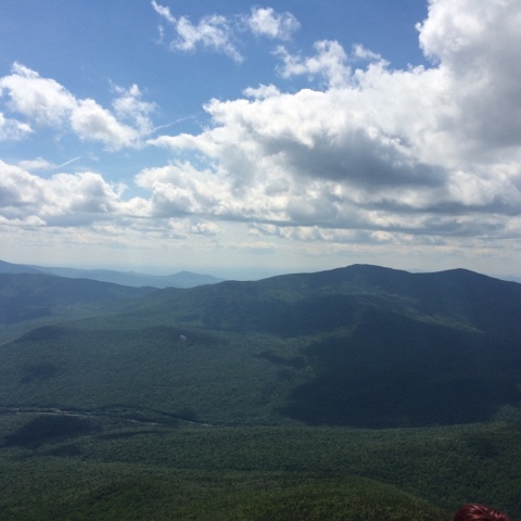
Reaching the top of Mt. Flume was exhilarating and we took a short time to take in the views. But we were behind schedule, and didn't eat a proper lunch. I was crestfallen despite the high of the ascent. I could see we would lose almost 1000 feet before we had to climb back up 1000 feet to gain the summit of Mt. Liberty in the distance, peak number two. 


I had severely underestimated the elevation gain and loss we'd experience between these five peaks. This was no hike at all, and suddenly my pack felt a lot heavier as my morale weakened. It was a costly mistake, as it became painfully clear that our pace had slowed to an average of less than one mile per hour. The 10.3 miles to our chosen campsite, and only source of potable water, now seemed daunting and maybe impossible. 

Did I mention water? We carried in four liters of water as well as a 16 oz. Gatorade each. Once you begin to ascend Flume, there are no water sources along the Franconia Ridge Trail. The next questionable water source is Garfield Pond at the base of Mt. Garfield. We'd hold out for the fresh water spring at the Garfield Ridge Campsite, our destination. Even with my Platypus Gravityworks filter, we didn't trust the dark, still water of Garfield Pond, and we couldn't evaluate the quality of the water or safely navigate a route to the shore when we'd finally arrive there at deepest twilight. 


But I'm getting ahead of myself. After Flume came Liberty. We set a goal to summit by 1PM, and failed again, this time by over an hour. The reality of our pace was setting in, as the sun began to dip toward the western horizon, and three summits stood between us and camp. 


The view of Mt. Lincoln ahead was stunning, and not just for its impressive beauty. I realized that at the highest, windiest points along this trail, we'd be climbing over the summit, pulling ourselves up over the rocks and boulders, not hiking. It took my breath away in more way than one, as I slouched under the weight of my pack. Another mistake: I wasn't eating, so there was no fuel for my legs, which were already screaming at me, and had been since our first climb of the day. Our pace deadened, and I required a five minute break after every 50 feet or so.  


We link up with the Appalachian Trail, and the famed Franconia Ridge when we reach the top of Little Haystack Mountain. This peak is less than 5000 feet and sits between Liberty and Lincoln. After Mike actually had to physically help me carry my pack over several obstacles, we finally ascended Lincoln, completely alone as the orange and pink sun began its final descent, and we saw mighty Lafayette taunting us in the distance. We let out a hoot as we tapped the summit, and moved on, crossing over two strange rock formations that separate the two peaks.
 
By now it was 5:30PM and after taking nearly an hour to descend from Lincoln, we were climbing Mt. Lafayette, our fourth peak. The last of the day hikers were trickling down from the summit of Lincoln behind us, and the environment ahead quickly became surreal, inhospitable, lonely and alien. The wind was strong and offensive, almost lifting us up off the ground despite our leaden packs. A vulture circled ominously overhead above Lafayette's summit, which was rocky and twinned with tortured brush and pine clinging to the rocks and life, adorned with the foundation of an old Lodge that sat up here in the 60's. The only company we had were these strange cairns set along the trail to lead AT thru-hikers, or anyone unlucky enough to get stuck up here in bad weather through fog and clouds. They reminded me of the Pukel Men from the Paths of the Dead in the Lord of the Rings: the Return of the King. The cold winds prompts me to  put on my down jacket and I quickly sweat out any and all water I'd actually consumed.


We finally reached the Garfield Ridge Trail junction on the north-side of Lafayette's summit, which would lead us to our final peak, Mt. Garfield, and our camp on the other side. It was 6:30PM, and we again foolishly convinced ourselves we'd move faster than we were capable, estimating that we'd reach camp before we lost daylight. Wrong again. 

Now we could see how far away Garfield really was, and the full gravity of my mistake sank in. Exhausted, thirsty, and struggling to keep a good pace, what little morale I was maintaining was carried away in the wind, and lamented my miscalculation. But with no place to camp and no water source, there was no choice but to move forward. I took no more pictures that day. The entire focus became our safety and well being. We burned by Garfield Pond, not even pausing to consider the black water. Besides, the sun was long gone, and we couldn't see any manageable direct route to the water's edge. We had 32 oz. remaining to get us to camp. 

Night descended upon the forest, and with it, our experience changed dramatically. The air became suddenly moist and the temperature plummeted, as a cacophony of crickets and nocturnal creatures awakened to sing their siren song. We were on the western side of Mt Garfield ascending when we lost twilight. I donned my headlamp and Mike attached his LED lamp to his shirt. It would be each of our first night hikes in the wilderness, an experience neither of us will ever forget. We weren't scared or panicky. A better way to describe it would be a hyper-vigilance. And it's a good thing, because at this point my legs had a bad case of the 'wobbles' and we were constantly slipping and sliding down slick and slimy rock formations in deep darkness. 

Right as I began to question the route we took in the dark, we heard the sweet sound of the Garfield Ridge Campsite spring, and rounded a corner to the camp area's entry. We filtered, chugged down two liters each, then filled up again and hiked the final distance to the only open tent area at 10:30PM. The camp was full of residents, but everyone had already gone to bed for the night.

I made a feeble effort to prepare dinner in the cold and dark without disturbing our neighbors who were already sleeping when we set up. Mike took some hot chocolate and turned in for the night, and after a few bites of food, I stored our stuff in the bear box and settled into my tent. This didn't turn out to be the camping trip either of us had imagined, and the whiskey, pipe tobacco, and other treats go untouched. 

In the morning I'm awake at 6AM and boy am I ready to go home. Mike takes some convincing to awaken, but soon were both packing up and drinking some hot coffee. We chat with our neighbors; they'd come up a 3 mile trail the previous day. Sounded a lot nicer than our slog across five peaks. 
We're on the trail at 9AM, and it starts to get dangerous again fast. The trail drops down a cliff along drainage for a water way. They shouldn't even call it a trail. Mike and I slip and slide our way down from one hand hold to the next until we finally reach our junction with the Franconia Brook Trail. We take it, and the trail takes us down deep into the Pemigewasset Valley. 
 

The going is muddy and wet, and sometimes some navigation is required, but overall today is a lot easier. I'll take stumps and sludge and minor navigation over the death march I led us on yesterday. We glide by a pair of beaver ponds, and cross a few treacherous brooks and streams by hopping across the rocks. It's a beautiful June day, the sun shining brightly sparkles and dances on the rushing water. It's been a brutal 36 hours, but its moments like this that make it worthwhile.  
 

We hit our final junction, the Lincoln Woods Trail, the same one we started on, closing the loop. Soon we start to see more and more day hikers and know we're close to the end. By now I'm dizzy with dehydration, and nearly puked when I tried to choke down a nutrition bar. I did a horrible job managing my food and water intake on this trip. It's a miracle I even made it, but I'm happy this happened here on a weekend trip, not on the three week adventure I've got planned a month out. 
 
Soon we see the sun shining on windshields of cars in the parking area. I'm grateful for the lessons I learned in the White Mountains, and Mike is grateful I didn't puke in his car 15 minutes after we merged onto the highway.
 
The JMT is only a month away.  

Sunday, March 1, 2015

Super Sunday

Luck. Chance. Serendipity. Coincidence. Karma. Destiny. Fate. Fortune. 

Facsimile. 

I will never forget Super Bowl Sunday 2015. But not because of the game or the commercials or the chicken wings. Nope, not even that horrible call at the end. 


On the Saturday night before the game, our hope of obtaining a permit to hike the Muir Trail this year hit a desperate low-point. While both of us managed to fax our applications for Saturday, the receiving fax was continuously busy for the Sunday application time-window (5:00PM PST Saturday-7:30AM PST Sunday). 

Busy?!
I was the first to challenge the brute, but all of my attempts to dial in on the wyrm failed. I resigned to retreat until the morning. My brother tried valiantly for three hours, over one hundred times. Defeated and deflated, he gave up at the stroke of midnight, waking me up with a woeful text breaking the news that he couldn't get through, and he hoped I would in the morning. 

The next morning, sword and shield in-hand (hazelnut latte, chocolate croissant), I went at the foul beast. But despite my numerous attempts to send a fax both online and from a traditional machine, I was bested by the vile creature, and over one hundred attempts failed. 7:30AM PST ticked past me tauntingly from the crookedly hung clock in the FedEx Kinko's, eliminating our chance to apply for a permit not subject to the new exit quota, and perhaps to hike the JMT this year. 

My brother began to consider abandoning his heraldry, going rogue in the mountains without a proper permit. I suspected a horrible conspiracy. The fax machine must be disconnected. Over-loaded. Unplugged. Out of paper. Out of ink. Out of something. Of course a federal agency relies upon fax for something this important. How efficient. 


I turned to the JMT Yahoo Group for help, asking the greater hiking community if anyone else was having difficulty getting through. Several members responded with similar tales of defeat, and endless busy/no response signals. Not necessarily helpful information, since we already knew we weren't getting through. 

I devised a new strategy. Was anyone able to get a fax to send? After asking the Yahoo Group, at 9:30AM PST, a member said his online fax was sent. I immediately fired one off online and called my brother to tell him, and despite the timing, he decided to stop into his station on his way to stock up for the game, and faxed his Sunday application a whole four or five hours after the lottery window had closed. 

After the game I checked back with the Yahoo Group, and the member who first claimed his fax finally went through said he received confirmation of his permit reservation. I checked my email for the 1,000th time that day: nothing. I'd be suspended in limbo for now. 

Naturally I texted my brother, telling him some dude on the Yahoo Group claimed he got his reservation for Sunday and that its verified he faxed it after 7:30AM PST. Weird. 

My phone suddenly rang: it was my brother. Nothing unusual, as often times we'll start a conversation via text and transition to a phone call to talk details.

He wasn't the guy from the Yahoo Group, but he got just as lucky! I launched myself six feet off of the couch and performed a tactical roll into the bedroom, hooting and hollering, vaulting onto the bed, jumping up and down. 'We got it?! What date?! 7/19?! The day we wanted?! Happy Isles to Mt. Whitney?! The day we wanted?!'

The day we wanted. What's more, on an application faxed in four hours too late and picked on a Sunday. The very last day we could try for a permit without being burdened by the yolk of the new exit quota. It's nothing short of a miracle we got it.

My two applications for Sunday and Monday were denied, the latter of which was specifically denied because the new exit quota was filled. That means there was space at the trailhead I wanted, but no more spots on the JMT exiting over Donahue Pass. Message boards have since been filled with the same woeful tale of denied applications because of the new quota, forcing many to give up on the dream of hiking the JMT this year. 


Believe it or not, acquiring this specific wilderness permit was the single most (seemingly) insurmountable obstacle to our specific and tailored plan to hike the JMT this summer. 

Now it's officially OFFICIAL. This summer, my brother and I return to the Sierras to follow in Dad's footsteps on the John Muir Trail. The adventure begins July 19, 2015! 


Sunday, February 1, 2015

Permitory

Oh how things can change overnight. I mentioned that a permit is required to hike the JMT, which is applied for in a lottery by fax. 


Due to overuse and increased human impact along the John Muir Trail corridor in Yosemite, Yosemite National Park just dropped a bomb on us, and everyone else planning to hike the Muir Trail this year and in the foreseeable future. Besides the limited number of permits available at the traditional trailhead at Happy Isles, we are now subject to an "exit quota."

This will limit the number of human beings who can be on the JMT and take Donohue Pass out of Yosemite, which is on our docket for day 4. It becomes effective tomorrow, February 2, 2015, and all permits applied for from then on will be subject to the exit quota. No use in divulging the details, but it should suffice to say our chances may be even more limited than before.

The quota is a great idea. It will prevent fly-by-nighters from deciding to hike the JMT on a whim and going to get a walk up permit. It also prevents people from using alternate trail heads to link up with the JMT. Really, it forces anyone who's interested to plan in advance and apply like my brother and I are doing for the traditional starting place, and allows the Yosemite Conservancy to begin the long work of restoring these areas of the trail. Only 20 JMT thru-hikers per day may go over the pass.


Whether it actually affects our chances or not, we immediately pivoted (see "panicked") and began applying on Thursday night after we got word of the press release. Both of our first applications were denied.

To make matters worse, neither of us were able to send our application for July 19, 2015 within the time window prescribed by the permit office. I've spent more time than I ever want to at a FedEx Kinkos, and after typing it hundreds of times I will never forget the freaking fax number for the Yosemite Conservancy Wilderness Permit Office!

My nemesis!
We're trying to stay positive after exposure to what seems like a new major obstacle to our goal. This whole application process is incredibly stressful and frustrating, especially in light of all of our planning and preparation. But we won't give up, and we're just going to keep faxing them in until we get a permit. Wish us luck!


Saturday, January 24, 2015

The Dirty Details

Some, and indeed probably most of those reading this don't know much if anything about the John Muir Trail. Californians and hikers will know it by name, but most are limited to an awareness that it's a long distance hiking trail in the Sierra Nevada mountains, and consider my brother and I to be 'crazy' for giving it a try.

So I thought a brief-ish overview of the trail will help those following in Dad's footsteps alongside us. 

Disclaimer: this journal isn't designed to function as a resource to plan your own Muir Trail hike. It may help others in the future, as I know online journals from thru-hikers have been an invaluable resource for us. But all the details and numbers are approximated solely for reference, and it's really meant to be followed along and enjoyed. 

With all that in mind, let's start with some history. The John Muir Trail is a 211 mile hiking trail in the Sierra Nevada, named to honor renowned naturalist, and founding-member and Sierra Club President John Muir. It was constructed to accommodate stock animals - that's right, cattle, mules, horses, etc.

Muir man than I'll ever be.

The Northern Terminus (or start/end point) is the Happy Isles trailhead in the Yosemite Valley, the Southern Terminus is the summit of Mt. Whitney. The summit of Whitney is the highest point in the contiguous United States (the Lower 48) at 14,505 feet. Hiking the final miles from the summit to Whitney Portal (and back to reality) will bring us to a grand total of 220 miles. 

Thru-hikers either go south-bound ('SoBo') beginning in Yosemite, or north-bound ('NoBo') from the Whitney zone. Dad hiked south-bound, which is the most popular direction and our choice. The only trailhead that may be harder to get a permit at than Happy Isles is Mt. Whitney Portal. More on permits later.

220 Miles
Over the course of our hike, we'll gain a grand total of approximately 47,000 feet of elevation, and we'll lose a grand total of approximately 36,000 feet of elevation. As our itinerary currently stands, the most elevation we'll hike up in a single day is approximately 4,000 feet, and the most we'll hike down in a single day is approximately 6,500 feet, when we exit at Whitney Portal.

JMT Elevation Profile, courtesy of the Pacific Crest Trail Association
We'll ascend and cross 9 mountain passes (11 if you include the summit of Whitney, and puny Island Pass), some significantly more challenging than the others. We'll do our best to stay off these passes in the afternoons, since unpredictable and potentially dangerous Sierra thunderstorms tend to form during the mid to late day. We've set ourselves up strategically and plan to camp near enough to the base of each pass to cross each one by mid to late morning the following day.

We'll take 20 days to hike the JMT. One of those days will be a ZERO day at Muir Trail Ranch, a remote stock ranch up in the mountains that offers accommodations and services to JMT hikers. We won't hike that day, and we'll stay in a tent cabin, shower, do laundry, and eat real food. Daily mileage will vary quite a bit, and while we have a detailed plan and itinerary, thru-hikers agree that flexibility is key. 

Carrying all of our food and provisions for a 20 day adventure from day 1 would be 'crazy.' We'll resupply 3 times: day 3 at the Tuolumne Meadows U.S. Post Office in Yosemite National Park; day 6 at Reds Meadow Resort in Mammoth; and day 10 at Muir Trail Ranch. Our resupply caches will be shipped ahead of time in large, protective, heavy-duty buckets that will contain our food, batteries, toilet paper, and anything else we can legally ship and resupply. Assuming everything goes to plan, our properly-labelled packages will be waiting for us at each location when we arrive. The system isn't perfect, and sometimes thru-hikers are forced to improvise when their package doesn't turn up. A solo hiker in summer 2014 actually found her Muir Trail Ranch resupply bucket arrived EMPTY, a first even for the people who run the Ranch.

A common resupply bucket
Some folks can't handle the weight of a 10-day food supply, and resupply again after Muir Trail Ranch, but that requires either hiking off-trail, enlisting a pack-train, or convincing someone to hike in a package for you. Our final resupply will be at the Ranch, leaving us with 9 days worth of food, and leaden packs as we approach the hike's most remote regions and aggressive passes.

A Wilderness Permit is required to hike the John Muir Trail. A reservation is available by lottery or by walk-up on a 'first-come, first-served' basis. Obviously they can be difficult to acquire. We can apply for our reservation exactly 168 days before the day we want to begin the hike. In compliance with the Wilderness Act, primarily to ensure backcountry visitors truly feel immersed in the wilderness, the number of permits out of Happy Isles is highly limited. We may have to try a few times, but we'll keep applying until we get the permit we want. 

Regulations require us to carry bear-proof canisters to store our consumables and smellables. These are designed more to protect the bears than to protect us: once a bear gets into a human food supply, its a death sentence, as the bear will almost certainly become a nuisance to humans from then on, and the Parks Department will eventually be forced to kill the animal. Hanging your food in a bear bag is illegal in Yosemite and other places, since bears are crafty creatures, and the smarter ones will figure out your carefully hung edible-puzzle. At the end of the day, the canister is the best way to protect your food, and to protect wild animals by keeping them wild.


Bear-proof canister

Many backpackers, especially ultralight gurus, absolutely hate these things: they're heavy, really bulky and the lighter carbon-fiber models get to be pretty expensive. But there's no use complaining about it, as its a necessary and legally-required evil. Besides, they're highly effective at keeping bears and any other Sierra critters that come sniffing around at night out of your food. I plan to rent a Bearikade from Wild Ideas (not pictured), which will fit my 10 day resupply. 

So now we're caught up to today. My brother and I have been planning non-stop since September 2013. From testing our gear and trying out dehydrated meal and camp coffee recipes, to reading and absorbing as much information from as many resources as possible, we've been eating, drinking and sleeping the JMT for almost a year and a half. 

Now we're almost ready, and the dream keeps getting more and more real. There's still many things that have to fall into place before everything is confirmed, but we've made our plans, and both of us have acquired or upgraded most of the gear we're going to need up there. We'll apply to begin the hike on July 19, 2015, making our permit application date February 1, 2015. Send us some good vibes and mojo! We're going to need it.

The next time you hear from me we'll have our permit. Then we can finalize our menus, set our resupply and travel plans in stone, pick up any missing pieces of gear, and get ourselves into pre-trail shape. Wish us luck!

Sunday, January 11, 2015

Breadcrumbs

Dad collected lots of small, seemingly unimportant things. He liked to keep tokens from people he'd met, things he'd done, or places he'd seen, most likely to act as reminders for when memories faded. That made the top drawer of his dresser pretty interesting to explore as a little kid. It was a chest filled with strange rings, coins, rocks (I know...), pins (mostly for merit from the U.S. Postal Service, if you knew Dad, that should explain), and a myriad of other small items he'd collected and kept throughout his life. 

After my brother brought up hiking the Muir Trail, the topic dropped off a cliff a bit. We would discuss it every now and then, but it was far from maturing into a real plan.

I'll never forget the sunny afternoon in September 2013 when Mom showed my brother and I an ordinary sheet of lined paper that would compel both of us to attempt the hike in 2015. 

My girlfriend and I were visiting family out in California; it was our last day there, and my brother had come by for a visit. We hadn't spent much time together, and it was our last chance to catch up for a bit before I flew back to New York. I opened up an old box while going through some of my things to find a disorganized cache of family photographs. It was a haphazard collection of pictures of my siblings and I as children, Mom and Dad in their youth, and everything in between. 


Young bucks on the Muir Trail in the Ansel Adams Wilderness, September 1996.
At the bottom were a bunch of framed pictures of Dad in the mountains that used to hang proudly in the hallway upstairs. One of them in particular struck me: a photograph of him sitting on a rocky out crop, his long lean legs folded underneath him, profile shadowed as he gazes across a sunlit range.

The photograph is in my first post. I'll never forget how it made me feel. I wanted to sit right there! Earn the right to enjoy that view.

When I showed my brother the picture and the John Muir Trail came up in that living room yet again, Mom produced another box. It had some of Dad's most guarded memories in it: things from his childhood, like old backpacking gear, and even some of his boy scout memorabilia. But the box was mostly filled with momentos he'd kept from his kids: Father's Day cards we'd made in school; a hilarious note from my sister apologizing for breaking her window and offering her $5 allowance to pay to fix it. These were the sorts of things he collected and kept with him. 

The most important item to come out of that box for purposes of this story was a single sheet of lined notebook paper. On that thirty eight year old brittle sheet of paper, written in pencil in Dad's flowing script, was his John Muir Trail itinerary from 1975. It's a pretty crude log, where he recorded each day's campsite, daily total mileage, and each day's ending elevation.

It's a tad inaccurate, and just a piece of notebook paper, but to us it was like a sacred document. We stared at it with wide-eyes, drank in the schedule. The daily mileage wasn't even that bad!

Dad's John Muir Trail Log


This was the flare I'd been looking for, the moment that 'we should do that,' became 'we can do that,' which rapidly turned into 'let's do it!' It was September 2013: it only made sense that we'd follow Dad forty years later, and hike the John Muir Trail in 2015 in his honor and memory. 

He also left a personal journal of his hike that I've kept. It's not necessarily a guide, a little difficult to decipher, and doesn't contain a whole lot of practical information on the trail, besides, the JMT has changed much since he walked it. It's more a glimpse into his own experience. He addressed it to us in the hopes that it might lead us to the Muir Trail, or at least to some understanding of how the experience impacted his life. 

Dad's John Muir Trail Journal

So we had an idea: to walk from the bottom of the Yosemite Valley to the summit of Mt. Whitney in summer 2015. Now we'd need a plan, lots of gear, and a ton of love and support. And a permit.


Saturday, December 6, 2014

A Family History in the Sierra

My siblings and I were lucky. We grew up in sunny Southern California, and during the summertime, when we weren't spending our days on the beach in the surf, there was a good chance you would find us in the mountains. Each of us developed an early love and respect for natural beauty thanks to our Dad, Robert. But please, call him Bob, and no neck ties, thank you. He's the chief instigator in this tale.

We frequented the Yosemite Valley for family vacations. When I was a scrawny nine year old, Mom let Dad take my brothers and I up the cables on Half Dome, a challenging climb up the round side of an 800 foot granite dome, following an 8 mile hike gaining 4500 feet of elevation. Keep in mind this was the day after Dad marched us from the Valley floor to the top of Glacier Point (the shuttle hadn't opened due to heavy snow that year), then on the 11 mile Panorama Trail to Nevada Falls. This was a typical "vacation" for our family. But it was ours, and we loved it.

Dad with me and my brothers on the Diving Board, June 1995

There was also a trip in 5th grade with one of my older brothers. Dad took us to Mammoth, and the Ansel Adams Wilderness to see some amazing places we'd never been to before. To this day, Garnet Lake remains my favorite spot I've ever hiked to. We'd hiked a part of a famous trail too, but didn't care to notice at the time.

Picturesque Garnet Lake

Dad was a true mountaineer in his day. When I was very young, he would make us all sit down in the living room for one of his slideshows of his backpacking trip through the Sierra Nevada. He'd set up the old school screen and projector and show us a different world, with none of the common luxuries, disturbances or basic comforts of modern life. Dramatic vistas, clear running rivers, bright glaciers... Dad with a beard. Of course, as a child, I was bored as hell with it.

Dad being Dad

In 1975, Dad hiked the John Muir Trail, a 211 mile trek through California's Sierra Nevada mountain range. I can only imagine what his pack and dated-gear weighed for his twenty-five day journey. Things have changed quite a bit in forty years. His old external-frame Jansport backpack is still hanging in the garage at Mom's house. I used it once for a backpacking trip in the Sequoias in 8th grade. Never again!

Cooler than your Dad
We lost Dad to an aggressive form of oral cancer in 2007. It came out of nowhere and turned our family's world upside down.

My older brother is the other protagonist in this story. We both dealt with the loss in our own ways, but we were both guilty of forgetting much of what Dad taught us to value. We forgot about the mountains, clear streams and green forests, and turned to building our own lives. We both went off to pursue our careers, and while he stayed in California, I moved to New York City.

I can remember when he contacted me a few years back after a trip he'd taken to the Sierra Nevada; he had become inspired. He sent me a video with his phone: he was wearing Dad's old "Indiana Jones" hiking hat, hiking down from Mt. Whitney, and said he was going to hike the John Muir Trail.

I've kept an old journal of Dad's thru-hike he gave to me before he died, and considered the trip myself, but I'm an attorney and I live in NYC. I'm not supposed to take time off for a pilgrimage through the mountains with my brother. That's career-suicide right? A month off for a backpacking trip. Yeah right. The realities of adult life require me to dream about the Sierras instead.

I would need my own moment of inspiration.

Oh, the socks.